Precision Aerial Imaging and Geospatial Data Solutions
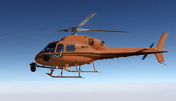
Successful aerial data or footage acquisition, whether for surveying across Hamilton County or filming over the Ohio River, requires meticulous mission planning, seamless sensor integration, and navigating complex regulatory approvals. Helicopters Over Cincinnati provides comprehensive project management for these specialized operations. We collaborate closely to assess your specific data or footage requirements, then facilitate access to the optimal helicopter and specialized aviation personnel best suited for that mission profile. We meticulously manage all necessary flight planning and permit acquisition, offering you a single point of accountability and a streamlined, turnkey solution for your critical projects.
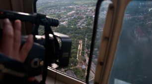
Cinema & Broadcast Videography
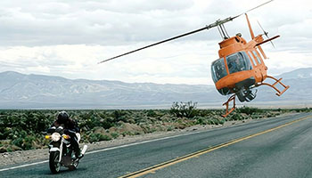
For high-stakes cinematic productions and live broadcast events throughout the Cincinnati metropolitan area, we provide access to exceptionally stable, high-performance helicopter platforms essential for Directors of Photography. We ensure compatibility with leading industry-standard stabilization systems, including Shotover, Cineflex, and Tyler Mounts. Our operational team coordinates seamlessly with your production crew, guaranteeing the precise aerial perspectives and flawless shot execution critical for capturing compelling visuals and meeting rigorous production schedules.
Aerial Photography
We provide high-resolution aerial imagery perfect for marketing, comprehensive real estate portfolios, and precise project progress documentation. Our expertise in lighting, angles, and composition ensures magazine-quality stills that showcase your assets effectively throughout the Cincinnati region.
LiDAR & Geospatial Surveying
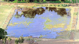
We deliver actionable data by going beyond visible spectrum imaging. Our capabilities include LiDAR acquisitions, precise orthomosaic mapping, and detailed 3D terrain modeling. These advanced solutions support critical urban planning, utility infrastructure inspections, and environmental monitoring projects across the Greater Cincinnati area.
Utility & Asset Inspection
Conduct rapid, detailed inspections of transmission lines, extensive pipelines, and vital cell towers. The stable hover capability and flight precision of helicopters ensure high-fidelity asset auditing, delivering critical insights for infrastructure managers throughout Cincinnati and surrounding communities.
Technical FAQ
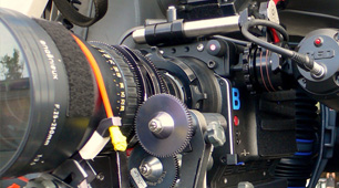
Our platforms are configured to accommodate all major industry camera mounts, including Shotover (F1, K1), Cineflex, and Wescam systems. For lighter cinema payloads, we effectively support Tyler Minigyro and Middle mounts, ensuring compatibility for your specific aerial production needs in the Cincinnati region.
Yes, we manage all necessary airspace authorizations and comprehensive flight plans for urban operations. Our team possesses significant experience in navigating complex controlled airspace, ensuring that your aerial imaging requirements are met legally and safely throughout the Cincinnati metropolitan area and its surrounding regions.
We offer flexible solutions; we can provide a skilled sensor operator as part of a turnkey service, or we can accommodate your own creative team. Should you bring your crew, we will ensure they receive a thorough briefing on essential safety and air-to-ground coordination protocols for seamless operations near Cincinnati.
Depending on the sensor payload, we deliver precise raw point clouds (LAS/LAZ), high-resolution orthomosaic maps (TIFF/ECW), or expertly processed 3D meshes. We collaborate closely with your GIS team to guarantee seamless file compatibility, ensuring immediate utility for your projects in the Cincinnati area.
Gallery
Aerial Photography
Camera Equipment
Camera Mounts
Damage Survey

Real Estate Survey
Aerial Videography
Comprehensive Aerial Photography and Videography Services in Cincinnati
Contact Helicopters Over Cincinnati at 1-855-445-8965 for a prompt, no-obligation quote on premium helicopter aerial photography services across the Cincinnati metropolitan area.